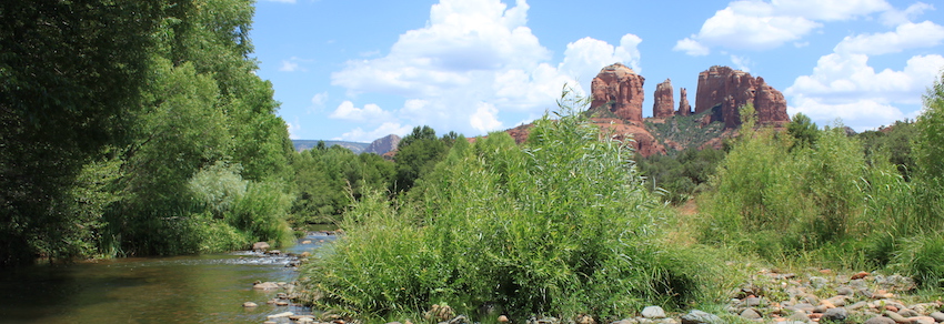
Sedona is one of those places I can’t get enough of, so I’ve been back again and again. In this post, I’ll list my all-time favorite day hikes in this natural wonderland and include tips on affordable accommodation, beating the summer heat, avoiding crowds, and more.
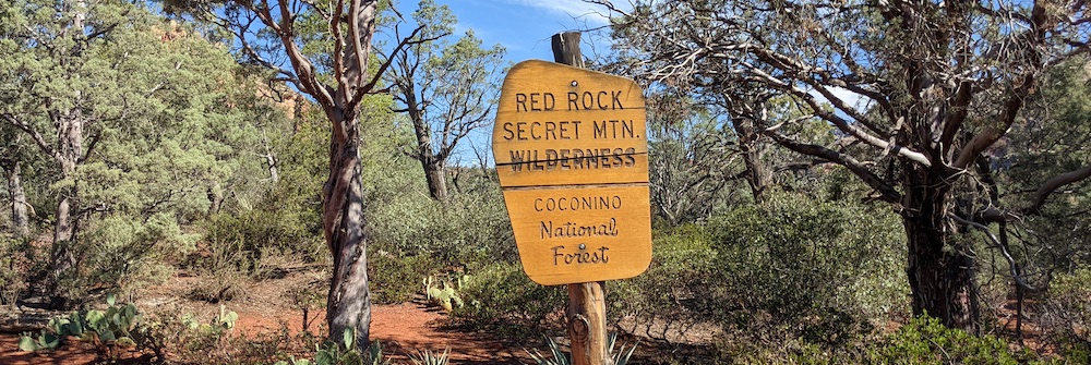
First things first: if you’re driving into Sedona from I-17, make sure to stop at the Red Rock Ranger Station/Visitor Center 10 miles south of town on State Route 179. There, you can learn about the geology of the area, purchase your Red Rock Pass (details below), ask for detailed flyers on the hikes you’re most interested in, and pick up a guide to heritage sites if you’re interested in seeing cliff dwellings and petroglyphs (see notes below).
WHEN TO GO
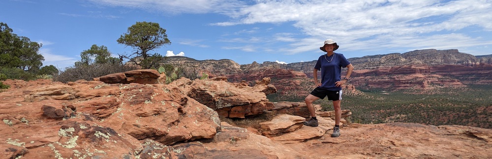
Sedona is best visited in March/April/May or October/November/December because summer temperatures can be extreme. On the other hand, Sedona is located at a high enough altitude that temperatures are not as high as in Phoenix or Tucson. July average highs are 38°C/100°F — but, as you’ve probably heard, “it’s a dry heat” which feels slightly cooler than what the thermometer indicates. I’ve visited three times in the past ten years, always in summer, once when the highest high hit a truly scorching 46°C/115°F. Even then, however, I was able to beat the heat — and most other hikers — by setting off at dawn each morning and being back at my shady cabin accommodation by 11:00 a.m.
BEST HIKES
Unlike some of the other hikes on this blog, these are all easy half-day trips of a few hours each, to be undertaken from a “base camp” in Sedona. Please note that this list aims to point you in the right direction. To actually navigate these trails, you’ll need a map or book like Bohan and Butler’s Great Sedona Hikes. To park at any of the trailheads, you need to purchase and display a Red Rock Pass ($15 for a week-long pass, $5 day pass, available online, in the visitor’s center, and from some on-site vending machines).
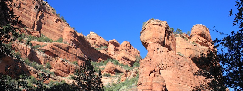
What makes a good hike? Scenic value is obviously a priority, but that’s not hard to achieve in Sedona! Another criteria is hiking in a wild, undeveloped place (versus a trail that skirts developed areas). Finally, I try to avoid spots frequented by jeep tours, as I learned the hard way along Broken Arrow Trail and at Chicken Point. On the other hand, I was curious to see Submarine Rock, and I really did marvel at the mountain bikers daring to ride the White Line when I hiked those trails, so even they have their appeal.
SAFETY
These trails are all well-trodden paths where you’d have to work hard to put yourself in serious danger. The heat shouldn’t be underestimated, though, so hike early, finish early, wear a hat, and carry plenty of water. Heading out of town will put you in mountain lion terrirtory, and while I don’t want to downplay the potential danger of a chance encounter, I’m sure there are many, many more mountain lion sightings of humans than vice versa.
Most of my visits to Sedona have been done alone. I’m always conscious of personal safety, but I was reassured by local solo female hikers I met along the trail who said they feel comfortable heading out on their own. (I did carry a small canister of pepper spray, though.) I suggest talking to rangers at the visitor’s center as well as asking solo locals their advice so you can make your own decision.
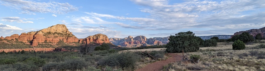
BRINS MESA/SOLDIER PASS LOOP - 10km/6mi loop, moderate terrain
Huge views and varied terrain makes this my favorite day hike in the Sedona area. I loved the solitude and scenery, especially in the “back” section where Brins Mesa Trail intersects Soldier Pass trail. The trail was just rugged enough in places to be interesting but easy enough to allow me to focus on the amazing scenery all around.
Starting from the Brins Mesa trailhead, follow trail markers up a long hill to the lip of the mesa, where the terrain opens up for huge views into Sedona’s backcountry. You’ll continue about another mile on this trail, then turn left onto Soldier Pass Trail at the lone intersection. Make sure you keep an eye on the trail because the beautiful scenery can easily pull you off course here!
Here on the upper reaches of Soldier Pass Trail, you’ll wind through beautiful stands of forest with great views of the mesas and rock formations all around. The trail is more obvious as you descend toward the pretty, but much overhyped “Seven Sacred Pools” and Devil’s Kitchen sinkhole. Finally, near the base of the trail, follow Cibola Trail to loop back to your starting point. I did this loop in three hours, having taken lots of photo and “oh wow” breaks.
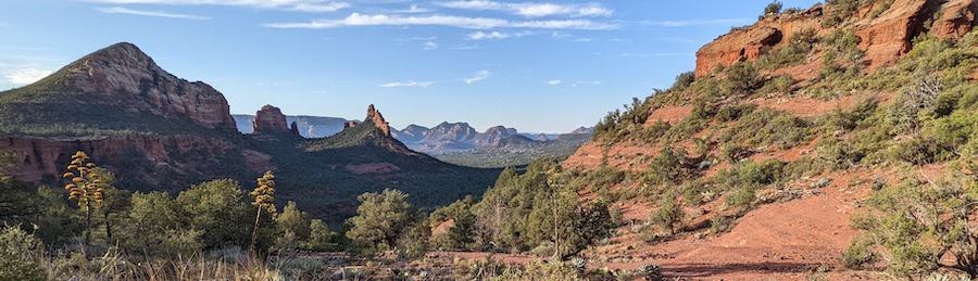
MESCAL TRAIL - 8km/5mi loop, moderate terrain
I stumbled across this trail when I finished a quick dawn hike to Devil’s Bridge and found myself with plenty of time for more. So I headed out on Mescal Trail on a whim and was impressed by the scenery and interesting trail. The trail hugs the slopes of a huge mesa, so you’ll be walking on fairly narrow shelves that drop off steeply in places. That definitely had me slowing down to watch my step at times, but it never felt precarious. Having said that, I only went about one-third of the way around before heading back to beat the heat. Now that I know how nice the trail is, I would set aside a day just to hike this entire loop trail. It also connects with Long Canyon, Deadman’s Pass, and Canyon of Fools trails.
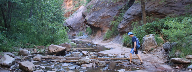
WEST FORK TRAIL - 11km/7mi total, out-and-back, easy
This is a gorgeous hike along the creek through a shady gorge that’s a delight in every way — except for the crowds it attracts. And those are hard to escape even with an early start, since this is an out-and-back hike. In addition, the trailhead parking lot charges its own $12 fee.
So much for the negatives, which are outweighed by many positives. Most visitors don’t venture past the half- or even quarter- mark of the dead-end trail, so you can enjoy peace and solitude on the “far reaches,” so to speak. You’ll cross the creek more than a dozen times, and there’s a certain, childish appeal to hopping or wading across each time. The winding creek also creates a sense of anticipation as you discover new views around every bend. In my book, this is a lovely, memorable hike that’s worth the annoyance of the fee and the popularity of the place.
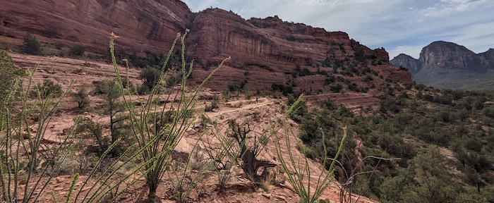
DOE MOUNTAIN - 4km/2.5mi, moderate
This is a fun hike up to and then around the rim of a mesa, with great views in all directions. You’ll sweat your way up the switchbacks to reach the top but then can meander and enjoy the eagle-eye vistas at any pace you desire. The only catch is that the trail around the top is faint in places, so it’s easy to get disoriented. Take care not to lose your way back to the main trail! Otherwise, it’s a great place to wander or simply find a nice lookout point from which to contemplate life. I only met one person on the way up and a few more on the way down, so it was a very peaceful hike.
FAY CANYON - 3km/2 mi, easy
This is a very easy, very pretty and shady hike along a winding path that passes beneath junipers and oaks. The trail dead-ends all too soon at the cliffy head of the canyon. There’s also a faint side path to a rock arch along the way. This is a lovely hike you can easily fit in any time your schedule permits — in the morning, in combination with the Doe Mountain hike, or around sunset.
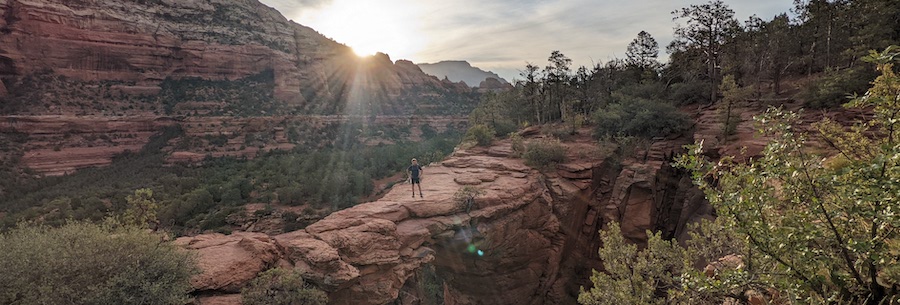
DEVIL’S BRIDGE - 6km/4 mi total, out-and-back, easy.
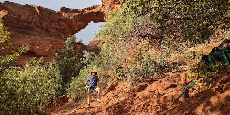
Devil’s Bridge is a long, slender rock arch reached by a easy, uninteresting trail (well, “uninteresting” by Sedona’s high standards). The problem is, the amazing photo opp attracts way too many people, so you have to arrive ridiculously early to make the trip worthwhile. Setting off well before sunrise gave me the place almost to myself — and the only other two early birds I met made it possible to snap a nice picture. That’s in contrast to alarming photos I’ve seen in which fifty or more people are packed onto the narrow arch, a scenario with zero appeal. So, if you can stomach a very early morning, Devil’s Bridge is definitely worthwhile. It’s also interesting to hike to a low point nearly under the arch for a totally different perspective looking up.
OTHER HIKES
I haven’t tackled it yet, but Bear Mountain is next on my list (8km/5mi total, strenuous, out-and-back), as is Lost Canyon Trail, which leads to an overlook with views of a cliff dwelling (total of 3km/2mi, moderate).
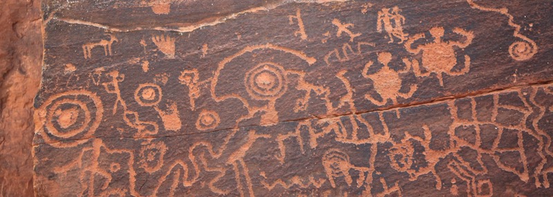
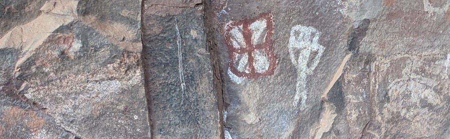
PETROGLYPHS
The cliff dwellings and rock art of the desert southwest are truly fascinating, and not just to a former archaeologist like me! It’s truly worth the effort (and it is an effort) to travel out to see these amazing, uncrowded sites. Note: some of these locations are down gravel roads and may close if the temperature exceeds 100°F, so check before setting out to avoid disappointment. I was happy to have the U.S. Forest Service booklet, Guide to Heritage Sites Coconino National Forest and Red Rock District, available at the Red Rock Ranger Station/Visitor Center, to help me interpret the following three sites:
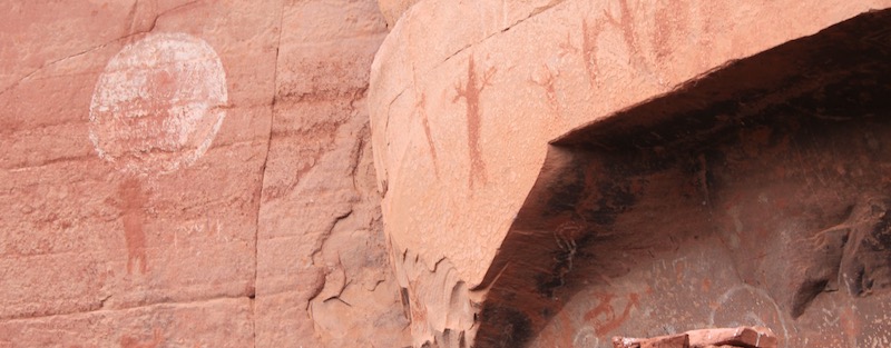
V-Bar-V Petroglyph Heritage Site located 18 miles south of Sedona, is really worth a visit. There are over a thousand fascinating petroglyphs a short walk in from the parking area. I had the place to myself one blissfully quiet morning, but it would also make sense to time your visit to catch an interpretive tour.
Closer to Sedona, you’ll find the Palatki and Honanki cliff dwelling sites. Palatki is run by the forest service, with reservations required. That will allow you to join a small group with a ranger who will talk you through the ruins and petroglyphs. Both are several miles down a bumpy, unpaved road that is passable with a regular vehicle in dry conditions. Honanki is open to the public, but Pink Jeep Tours have a monopoly on guiding visitors through the site, so you’ll be on your own in terms of interpreting what you see — making that Guide to Heritage Sites booklet especially helpful here.
In a perfect world, there would be an amazing, quiet trail to follow all the way out to these sites, but there doesn’t seem to be an option that doesn’t cut through private property. So sadly, you’ll have to drive in and out to visit and only do a little walking on site.
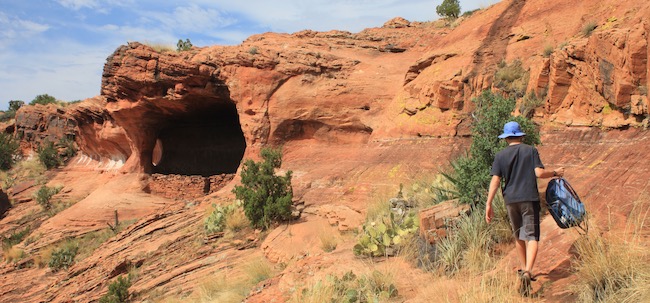
OTHER ATTRACTIONS
I’m not a fan of motorized vehicles in wilderness areas, but I did rent an ATV on one visit to Sedona to get out to Robber’s Roost with my young son. The bumpy ride there was his kind of adventure, and bushwalking to find the cave with its modest cliff dwelling ruins appealed to me. Once we found the huge cave, we enjoyed looking out over miles of stunning southwest scenery.
I’m also not a fan of high-priced adventures when so much nature can be enjoyed for free, but I did indulge myself in a ballooon ride and can highly recommend it. I loved soaring silently over the red rocks and canyons, and getting a bird’s-eye view of places I’d recently hiked made the experience that much more memorable. I went with Red Rock Balloons, with Northern Light being a second option.

ACCOMMODATION
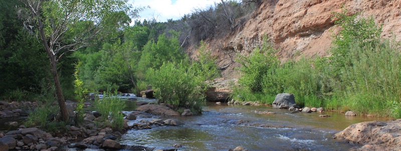
I won’t attempt to list accommodation options in and around Sedona — there are plenty for every budget. My go-to favorite is Lo-Lo Mai Springs, a 15 minute drive out of town on 89A toward Cottonwood. Lo-Lo Mai offers camp sites and cabins, and the beautiful location along Oak Creek allows you to cool off in the water on a hot day. There’s also a gurgling spring that feeds a pond frequented by dragonflies — a lovely, “small” sight that contrasts to the many grand wonders of Sedona.
I hope this has been helpful and interesting, either as a planning tool or armchair adventure. For other exciting trips and ideas, click on “HOME” at the top of the page. Thank you for visiting TheTravelBug.blog and happy travels!